The Golan Heights
The source of the River Jordon
The Golan
Heights is a high basalt plateau in the northeastern corner of Israel. It was formed by erupting volcanoes, whose
extinct cones, such as Mt. Bental, still line its eastern rim. Beneath its
otherwise mostly flat rocky landscape are huge bodies of groundwater (aquifers)
which fill up from the cold wet winters and melting snow from neighboring Mt.
Hermon. This is the source of the regions numerous perennial streams and
beautiful waterfalls, such as Yehudiya, Zavitan, and Devora, which flow into
the Sea of Galilee and Jordon River. In addition to being attractive hiking and
swimming spots, these waters provide Israel with 30% of its fresh drinking
water.
The Golan
Heights, or Ramat Hagolan as it is called in Hebrew, has been inhabited since
prehistoric times. In the Bible it is refered toby several different name: Golan, Horon, and Bashan. Sometimes
people say the “Dolmens” (the giant
stone tables) scattered about the region are the furniture of Og, King of
Bashan, who the Bible claims was a giant. During the Second Temple period, the
Golan heights had a large Jewish population and it was a center of olive oil
production. In 66 CEwhen the great
revolt against Rome began, the Roman army placed an emphasis on conquering
major Jewish centers in the Golan Heights in order to sever the link between
the Jews of Eretz Yisrael and their brethren in the Diaspora. A particularly
fierce battle was fought at Gamla, which came to be known as the “Masada of the
North”
Jewish life
did not end with the destruction of Gamla. In the Mishnaic and Talmudic
periods, the Jewish communities flourished, as attested to by the numerous
ancient synagogues discovered throughout the region. The “Talmudic Village” and basalt synagogue in
Katzrin are particularly fine examples of the rich Jewish material culture at
this time.
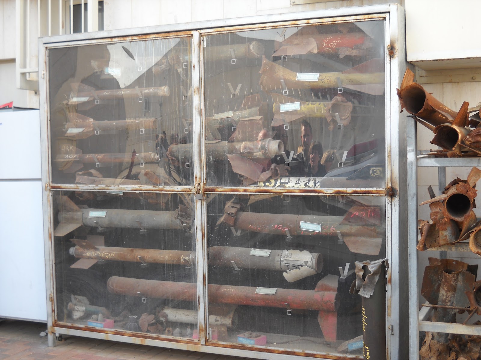
Over the
past 40 years, the Golan has been a source of contention between Syria and
Israel. Prior to 1957, the Golan was in
Syrian territory. The Syrian army took advantage of its dominant elevation over
farms and villages below in Israel to
shell and snipe at them on a regular basis. Numerous casualties were inflicted
on the Israeli civilian population. Many children in the kibbutzim below the
heightsspent virtually every night of their childhood in bomb shelters. On one
occasion, the Syrianseven tried to divert the headwaters of the Jordon Riverat
the Baniasin order to deprive Israelof its main source of drinking water.
This changed
in 1967. In a series of lightning strikes over 2 days, Israel captured the
Golan Heights during the Six Day War. This began a new period in the history of
the region. IN the wake of the soldiers came civilians who began exploring the
region as hikers, scientists, and archeologists. Soon kibbutzim, moshavim, and
other settlements began to appear, as a new generation of Israeli pioneers
began to follow I the footsteps of their ancient and modern forefathers.


